

Research Activities
Dr Tarek Taha currently leads the Robotics Lab at Dubai Future Foundation. He has more than 15 years of experience in the fields of robotics, autonomous
systems and artificial intelligence while working for both, industry and academia.
Having worked extensively in the robotics, autonomous systems and artificial intelligence domains, I have developed great interest in advancing the state of
robotics and autonomous systems to enable their deployment in practical applications.
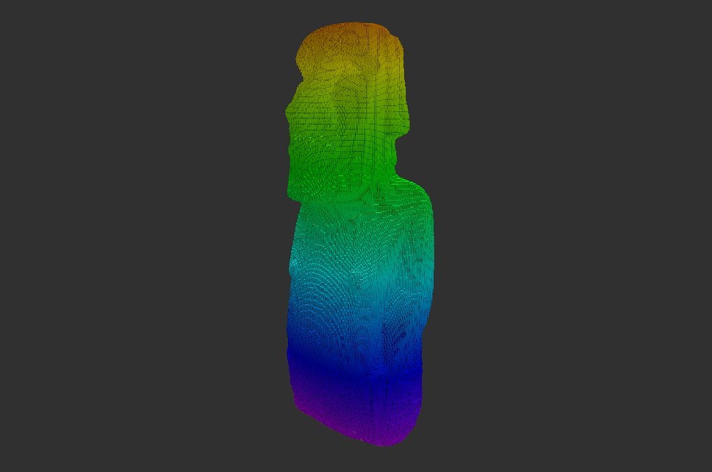
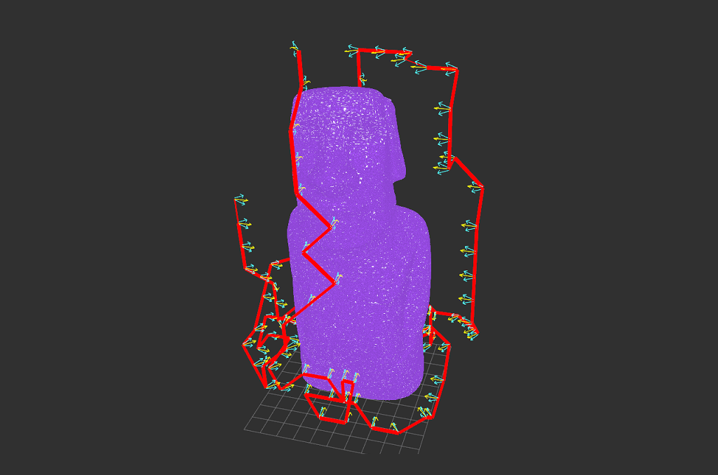
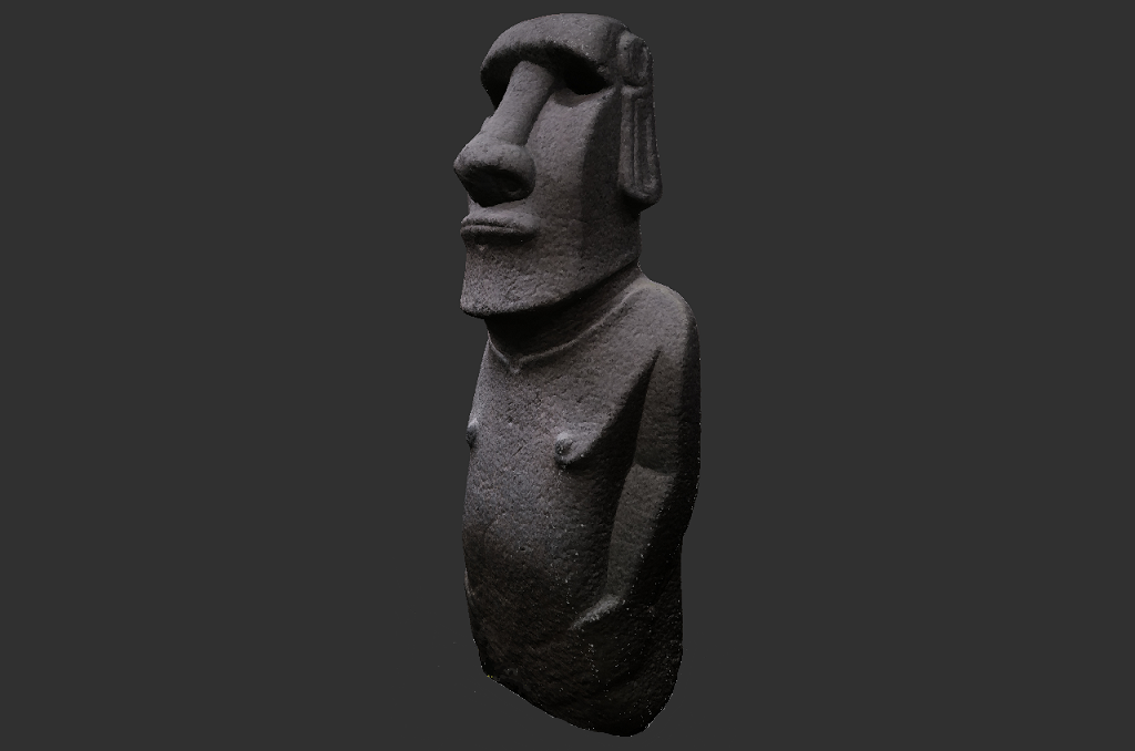
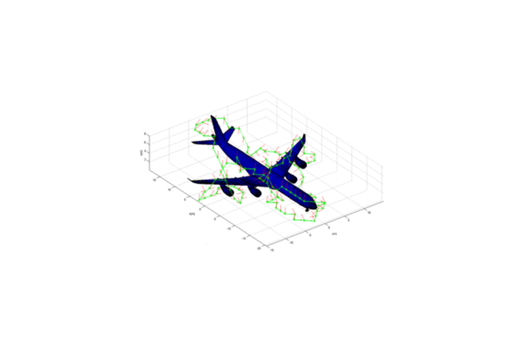
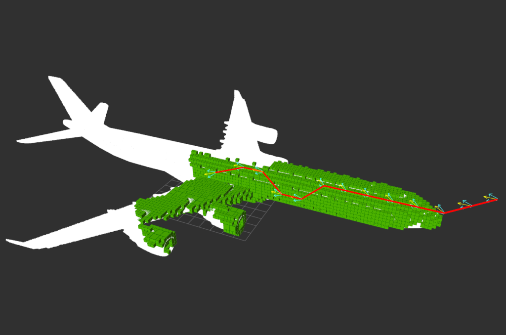
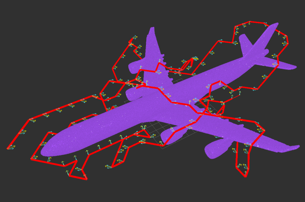
Coverage Path Planning
Collaborators
- Prof. Yahya Zweiri
- Prof. Lakmal Seneviratne
- Prof. Jorge Dias
Students
- Randa Almadhoun
- Abdullah Abduldayem
Relevant Publications
- A survey on multi-robot coverage path planning for model reconstruction and mapping
- Coverage Path Planning for Complex Structures Inspection Using Unmanned Aerial Vehicle (UAV)
- Guided Next Best View for 3D Reconstruction of Large Complex Structures
- Coverage Path Planning with Adaptive Viewpoint Sampling to Construct 3D Models of Complex Structures for the Purpose of Inspection
- Aircraft Inspection Using Unmanned Aerial Vehicles
- GPU accelerated coverage path planning optimized for accuracy in robotic inspection applications
Search and Rescue
Robotic Search and Rescue (RSAR) is a challenging yet promising technology area with the potential of high-impact practical deployment in real-world search and rescue disasters scenarios. Response time in a disaster environments is considered a key factor that requires a careful balance between rapid and safe intervention. SAR response should be fast and rapid in order to maximize the number of detected survivors/victims and locate all sources of danger in a timely manner. Appropriate disaster response should be organized and synchronized in order to save as many victims as possible, the primary objective in search and rescue operations. In general, responders have approximately 48 hours to find trapped survivors, otherwise the likelihood of finding victims alive drops substantially. Moreover, the conditions of SAR sites are usually hazardous making the SAR team more vulnerable, forced to operate in an unstructured environment with limited access to medical supplies, power sources, and other essential tools and utilities.
Collaborators
- Prof. Lakmal Seneviratne
- Prof. Jorge Dias
- Dr. Nawaf Al Moosa
Students
- Hend Al Tair
- Reem Ashour
- Randa Almadhoun
The research work conducted mainly focuses on:
- Exploring indoor environment in order to identify and locate victims using multi-sensors (e.g., electro-optical,thermal, wireless, stereo imaging etc.)
- Coordinating a team of robots and humans during search and rescue missions
- Semantic environment mapping that labels hazards and ranks them
Relevant Publications
- Victim Localization in USAR Scenario Exploiting Multi-Layer Mapping Structure
- Decision making for multi-objective multi-agent search and rescue missions
- Decentralized multi-agent POMDPs framework for humans-robots teamwork coordination in search and rescue
- Exploration for Object Mapping Guided by Environmental Semantics using UAVs
- Decentralized multi-agent POMDPs framework for humans-robots teamwork coordination in search and rescue
UAV based victim Localization
@article{goian2019victim,
    title={Victim localization in USAR scenario exploiting multi-layer mapping structure},
    author={Goian, Abdulrahman and Ashour, Reem and Ahmad, Ubaid and Taha, Tarek and Almoosa, Nawaf and Seneviratne,
    Lakmal}, journal={Remote Sensing},
    volume={11},
    number={22},
    pages={2704},
    year={2019},
    publisher={Multidisciplinary Digital Publishing Institute}
}
Exploration using Adaptive Grid Sampling
@article{almadhoun2019guided,
    title={Guided next best view for 3D reconstruction of large complex structures},
    author={Almadhoun, Randa and Abduldayem, Abdullah and Taha, Tarek and Seneviratne, Lakmal and Zweiri, Yahya},
    journal={Remote Sensing},
    volume={11},
    number={20},
    pages={2440},
    year={2019},
    publisher={Multidisciplinary Digital Publishing Institute}
}
Semantic Risk 3D Mapping
Exploration for Semantic 3D Mapping
Unmanned Aerial Vehicles (UAVs)
Various research activities related to UAVs focusing on:
- Fault tolerant UAV systems
- Aerial collaborative transportation
- Energy optimization during aerial missions
- Applications related to search and rescue, and construction site monitoring
Students
- Abdullah Mohiuddin
- Reem Ashour
- Randa Almadhoun
Relevant Publications
- Energy distribution in Dual-UAV collaborative transportation through load sharing
- A Survey of Single and Multi-UAV Aerial Manipulation
- State of the art in tilt-quadrotors, modelling, control and fault recovery
- UAV Payload Transportation via RTDP Based Optimized Velocity Profiles
- Fault Tolerance Control for Quad-Rotor UAV Using Gain-Scheduling in Matlab/Gazebo
- Site inspection drone: A solution for inspecting and regulating construction sites
- First-Principles Modeling of A Miniature Tilt-Rotor Convertiplane in Low-Speed Operation
- A framework of frequency-domain flight dynamics modeling for multi-rotor aerial vehicles
- Victim Localization in USAR Scenario Exploiting Multi-Layer Mapping Structure
- Exploration for Object Mapping Guided by Environmental Semantics using UAVs
Dual UAV collaborative transportation
Multi-UAV co-ordinated payload transport
UAV payload transportation via RTDP
Energy Estimation and distribution
Dual UAV payload transportation using RTDP
Site Inspection Drone
UAV wireless charging and tethering
Next Best View (NBV) with profiling
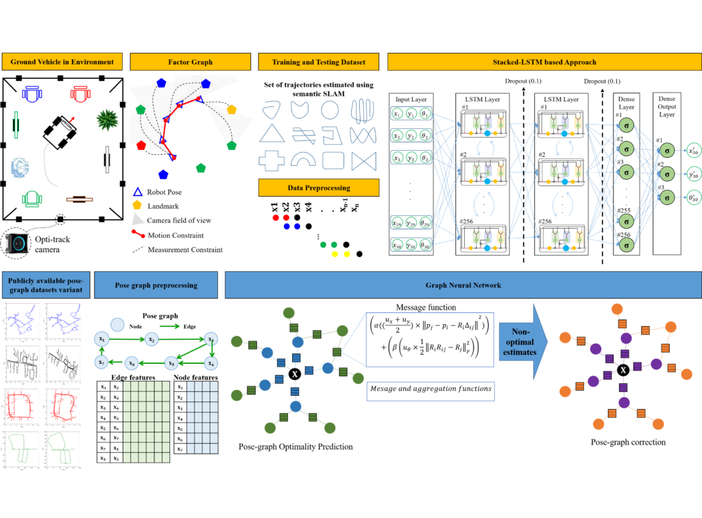
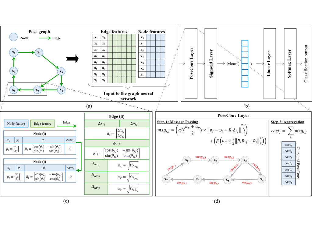
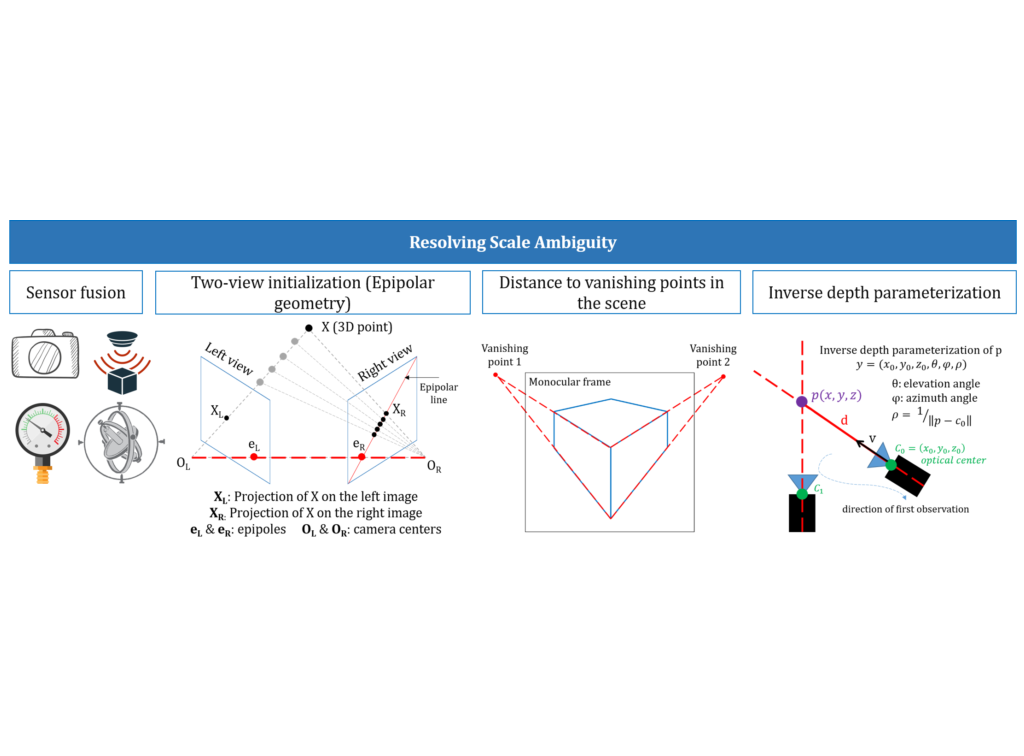
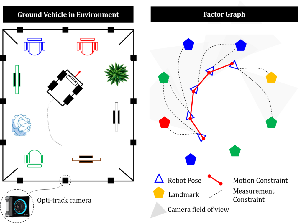
Simultaneous Localization and Mapping (SLAM)
This work focused on educing SLAM position estimation error by utilizing modern deep learning techniques and semantic scene understanding for a richer feature extraction.
Collaborators
- Prof. Shoudong Huang
- Prof. Yahya Zweiri
Students
- Rana Azzam
Relevant Publications
- A Stacked LSTM based Approach for Reducing Semantic Pose Estimation Error
- A Deep Learning Framework for Robust Semantic SLAM
- Feature-based visual simultaneous localization and mapping: a survey
Human Robot Interaction (HRI) in Assistive Robotics
The work focused on utilizing reinforcement learning to predict intentions during HRI for assistive robotics applications.
Collaborators
- Prof. Jaime Valls Miro
- Prof. Gammini Dissaniyake
Relevant Publications
- POMDP-based long-term user intention prediction for wheelchair navigation
- Intention Driven Assistive Wheelchair Navigation
- Wheelchair Driver Assistance and Intention Prediction Using POMDPs
- A POMDP framework for modelling human interaction with assistive robots
Intention prediction - wheelchair navigation
Intention prediction - wheelchair navigation
Path Planning and Navigation
The work focused on developing efficient and effective path planning algorithms for navigating robots in clutteredenvironments with narrow passages.
Collaborators
- Prof. Jaime Valls Miro
- Prof. Gammini Dissaniyake
Relevant Publications
- An Efficient Path Planner for Large Mobile Platforms in Cluttered Environments
- Sampling based time efficient path planning algorithm for mobile platforms
- An efficient strategy for robot navigation in cluttered environments in the presence of dynamic obstacles
- An adaptive manoeuvring strategy for mobile robots in cluttered dynamic environments